Lovozero (Luyavver) is the third largest lake on the Kola Peninsula. It is elongated from north to south, has a heavily indented coastline, large and small bays, numerous capes and about 140 wooded islands. The lake can be divided into northern, middle and southern parts, connected by narrow, shallow straits.
Tourists with little experience can travel along the banks of Lovozero. Entering the mouths of the rivers and arranging radial exits from the shores of the lake, they will get acquainted with the nature of these places, the population, and replenish their tourist experience. Most of the routes along the rivers of the eastern part of the Kola River start from Lake Lovozero.
Near Lovozero there is a village of the same name, an old churchyard founded in the 16th century, now a regional center. Here is the largest reindeer-breeding and fur-breeding state farm of the Murmansk region – “Tundra”. The village stands on the narrow Virma River, which flows into Popovskoe Lake, connected to Lovozero by a channel. The village of Lovozero is the gate leading into the depths of the peninsula, and the lake of the same name is the first significant body of water that must be overcome in order to reach the river section of the route.
The southern part of Lake Lovozero is the most picturesque. There are several large wooded islands, on one of which our tourist center “Russian Lapland” is located, and a large deep bay on the western coast – Motka-Guba. The bay is located in the throat of a valley that cuts through the massif Lovozerskie-tundry. Lake Seidozero (Seydyavr) is located 2 km from Motka-Guba, surrounded on three sides by powerful steep rocks. It is connected with Lovozero by the small river Seidyok. Almost parallel to the river, a path has been laid between the lakes; from Lovozero, it is not difficult to go along it to Seydozero, where you can spend at least a day. Here, from the south and west, high sheer cliffs rise directly from the water, only on the northern coast the mountain range recedes slightly from the coast, here a strip of forest stretches, swampy in places.
You can see a lot if you climb the spurs of Kuyvchorra (on the northern coast). To the east of the mountains opens a wide panorama of the plains: forests, rivers, countless lakes. On the sheer cliff of Kuyvchorra, which breaks off to the lake east of the Elmorajok river valley, there is a natural “pattern” about 70 m high and 30 m wide, which was obtained from a combination of wet spots on the rock that forms the rock and dark spots of lichen. The image resembles a human figure. They call him here the old man Kuyva (“Kuyva” – in Sami an idol). Legends and beliefs are associated with it.
The main waterways from Lovozero are the Kurga, Afanasia, Tsaga, and Sara rivers flowing into it. Only the Voronya River flows out of the lake. You can make an independent trip along Kurga, in addition, it leads to the northeast, to the basins of Iokanga, Kharlovka and Eastern Lipa. Athanasius serves as the main route to the Ponoi basin, Tsaga to the Varzuga basin (to the southeast), Sarah to the Umbozero basin (to the southwest).
The radial location of the routes from Lovozero to the basins of the large Kola rivers, combined with the convenience of access, determined the principles for constructing water routes here. Crossing the peninsula in all directions – to the north (Voronya, Kharlovka, Vostochnaya Litsa, Iokanga), to the east (Ponoi), to the south (Varzuga, Strelna), these routes form a dense network that overlaps its eastern part. What they have in common: crossing the Lovozero, ascending to the upper reaches of a small river, a long rafting down a large rapids river.
From the settlements of the southern coast of the Kola Peninsula (Lesnoy, Kuzomen, Strelna, Chapoma), which can be reached by sea, there are water routes that do not pass through the center of the peninsula. They consist in ascending one river and descending another, returning to the sea coast or ascending the river to its upper reaches and crossing into the basins of rivers flowing to the north or east. On the rivers accessible in the upper reaches (Umba, Kolvipa basin), rafting downstream is popular.
Considerable opportunities open up radial exits (on foot) to the tributaries of large rivers. There you can find a beautiful waterfall, a difficult rapid or just a picturesque place and meet hunters, fishermen, reindeer herders.
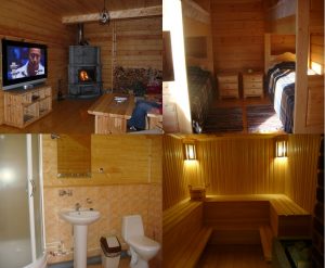
Individual and group tours around Lovozero. Transfers.
Call — Mon-Sun: 09.00-21.00