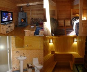
The Lovozero tundras is the second largest mountain range after the Khibiny on the Kola Peninsula in the Murmansk region of Russia. The Lovozero tundra are the oldest mountains on Earth, from the west they are bounded by Lake Umbozero, from the east by Lake Lovozero, from the north and south the taiga rises to the mountains. Lovozero tundra can be visited both in winter and summer, especially since our Russian Lapland camp site is located less than 5 kilometers from the Lovozero tundra and we can organize for you various walking and water trips in their surroundings with the involvement of qualified guides. The territory surrounding the Lovozero tundra is a reserved, protected zone of the Seydozersky reserve or Seidyavvr, its area is 17,400 hectares.
The Lovozero tundra has the shape of a horseshoe, in the center of which, the slopes of the mountains break off with sheer walls to Seydozero. These mountains do not have clearly defined peaks and passes. The main heights are located in the western part (mountain Angvundaschorrdo 1120 m), to the east the heights gradually decrease (up to 400 m). The rivers of the Lovozero tundra flow along the radii from the outer slopes of the massif into the marshy lowland and from the inner slopes into the central depression of the Seidozero. The rivers here are short, fast, full-flowing, have many rapids and waterfalls. In winter, the rivers do not freeze in many areas, but you can always cross them over numerous snow bridges. The river valleys are narrow and deep, and snow remains in them during the summer months. Throughout the territory of the Lovozero tundra there are small but deep lakes with the purest water.
The central part of the Lovozero tundra is composed of massifs (from north to south): Alluaiv, Angvundaschorr, Sengischorr, Mannepakhk. The central part is separated from the northern part of the massif by the large valley of the Elmorajok River, the Elmorajok Pass and the valley of the Ilmajok River.
The eastern part consists of the Swaluive, Puncaruive and Ninchurt massifs. The northernmost of them – Ninchurt abruptly breaks off to Seydozero and into the valley of the Chivruai River. All three massifs slope gently towards Lovozero. They are separated from each other by the valley of the Kuansuai stream and the narrow, rocky gorge of the Iidichyok River.
The northern part of the Lovozero tundra massif has the highest height in the western part – this is Mount Karnasurta (Raven Ridge) – about 950 m. Karnasurta adjoins the Elmorajok Pass from the east. On the eastern slopes of Karnasurta, the big river Vavnyok (Svetlaya) originates. Its wide valley divides the horseshoe arc into two parts – northern and southern. The southern part consists of Mount Kuyvchorr and the two-headed peak of Kuamdespahk (mountain of the Shaman tambourine). Three streams flow from the southern circuses of Kuyvchorr, forming the river Kokluhtiuai, which flows into the northern bay of Seydozero. From Kuamdespakhk, a stream flows down to Seydozero – Suluai. The northern part of the horseshoe is a spur of Karnasurta, the eastern edge of which stands out as the top of Vavpbed. The border of this division is a small pass with a large lake Svetloe.
In the north-west of the Lovozero tundra, in the valley of the Ilmayok River, there is the village of Revda, connected by regular bus service to the village of Lovozero and to the Olenya railway station. In the southwest, on the banks of the Umbozero, there is the village of Puncha, along the western slopes from it to Revda there is a motor road that operates all year round. On the eastern and southern slopes of the Lovozero tundra there is a communication line from the village of Lovozero, along which a trail has been laid.


